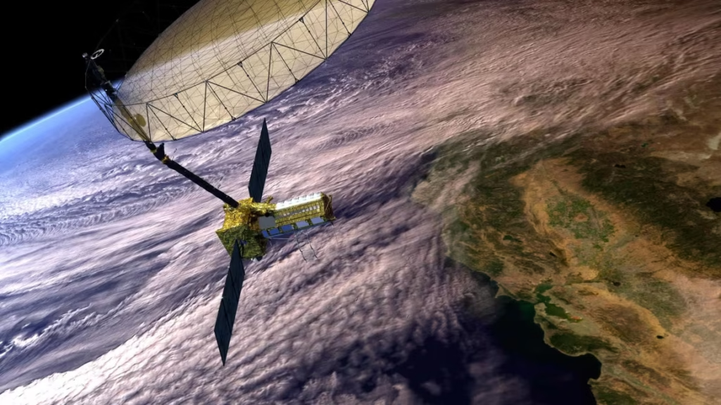
In a groundbreaking moment for international space collaboration, NASA and the Indian Space Research Organisation (ISRO) successfully launched the NISAR satellite on July 30, 2025. The joint Earth-observing mission, valued at $1.5 billion, is designed to deliver the most detailed and frequent radar-based mapping of our planet ever attempted.
NISAR, which stands for NASA-ISRO Synthetic Aperture Radar, carries a unique combination of two radar systems—NASA’s L-band and ISRO’s S-band. Together, they will monitor Earth’s surface changes with unmatched precision, detecting shifts as small as a few centimeters. This makes NISAR ideal for tracking glacier movement, land deformation, and natural disasters such as earthquakes, floods, and landslides.
The satellite was launched aboard India’s GSLV-F16 rocket from the Satish Dhawan Space Centre. It now orbits the Earth in a sun-synchronous path at around 747 kilometers altitude. It will cover nearly the entire planet every 12 days, creating a consistent global dataset crucial for climate science and disaster response.
NISAR stands out not only for its advanced technology but also for its commitment to open data. Scientists, governments, and disaster agencies worldwide will have free access to its findings—empowering better planning, environmental management, and early warning systems.
This mission symbolizes more than just technical success. It represents a deepening of U.S.-India space cooperation and a shared commitment to using science and innovation for the global good. As the world faces increasing environmental challenges, NISAR could become a game-changing tool for resilience and sustainability.


